The calculation of earthwork volume is often the controversy and focus in engineering budget and settlement. However, using the real-life 3D modeling method of the Star Series multi-lens tilt photogrammetry system to simulate the excavation and backfilling of earthwork stone can make the construction party intuitive and effective. The excavation analysis and calculation of the earth and stone side, to achieve the accuracy and refinement of the earthwork balance calculation, played an important role in project cost control.
Thoughts on the Calculation of Tilting Photography Technology in Earthwork Volume
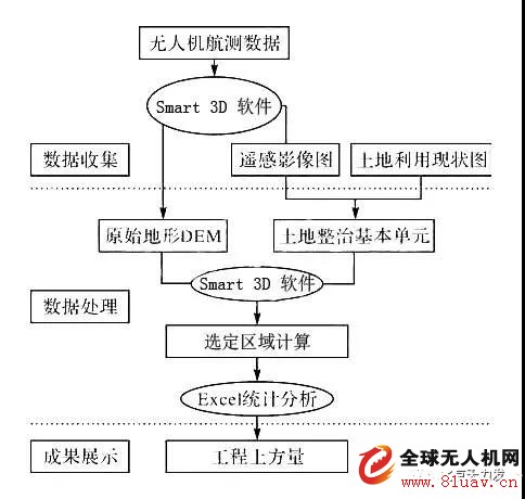
Problems to be solved:
1. How to extract initial data from the original landscape?
2. How to convert aerial survey data into 3D model?
3. How to get the amount of earthwork from the 3D model?
Solution:
1. Using the tilt photography drone aerial survey and point cloud 3D imaging technology to form model data;
2. The image data is processed by software to reach the raw material data of the model;
3. Import the data into the real-life 3D model of the Smart 3D software;
4. In the Smart 3D software, the earthwork calculation is performed according to the construction requirements.
1 Extract initial data from the original topography
The Star Series multi-lens tilt photogrammetry system has the advantages of multi-view high-definition image acquisition, low cost and flexibility, and is a powerful complement to satellite remote sensing and UAV aerial remote sensing.
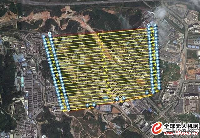
When the multi-lens tilt photography drone flies to the appropriate height, the onboard tilt photography system takes aerial photography from multiple angles of view. The aerial route uses an overlap rate of 60-80% (determined by the ground height) to and from the direction. The strips are gradually covered in all directions in order to achieve an orderly full coverage aerial photography of the terrain logic.
After the aerial photography of the drone is completed, you can view the image data folder of the SD card data storage SD card through the computer. The images in the folder are arranged in order by number. By observing the image, you can view the image between the upper, lower, left and right adjacent images. The range of overlap.
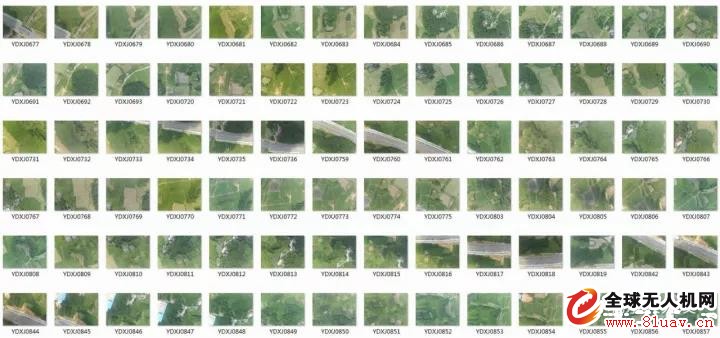
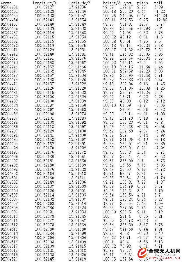
POS information such as latitude and longitude, altitude, and shooting attitude (angle) of each photo can be viewed through folders, which is the initial key information.
2 Initial data is converted to 3D model
The Smart 3D processing software can process image data with POS information such as latitude and longitude, altitude, and shooting attitude (angle) into 3D model data.
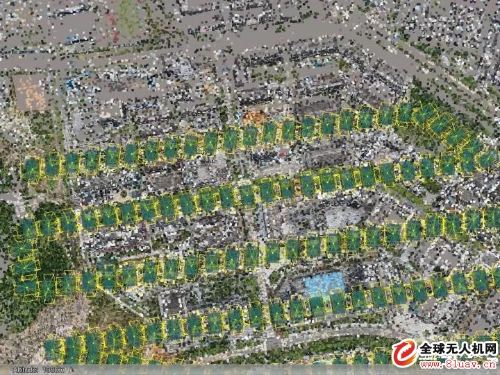
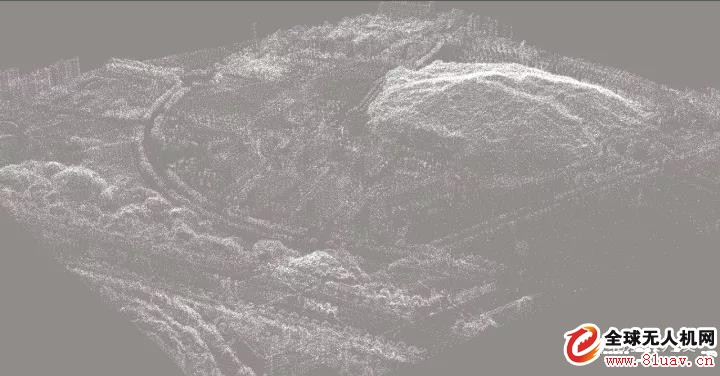
1. Align photos: Smart 3D will restore the position of each lens according to the latitude, longitude, and angle of each photo, as shown in the figure.
2. Create a dense cloud: Smart 3D will calculate the relationship between each point and include each identified point in the intensive calculation
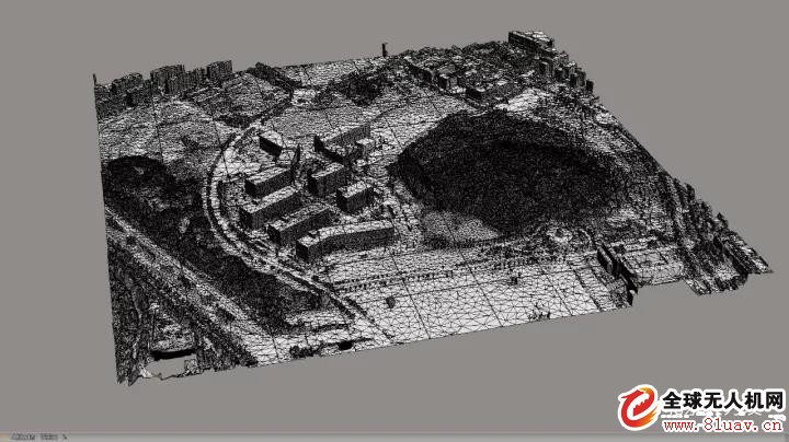
3. Generate Grid: Using software internal vector function relational algorithm, Smart 3D forms an irregular triangulation based on point cloud data to construct a 3D model of point line surface.
4. Generate texture: Smart 3D matches the depth images of different perspectives to the same coordinate, obtains the complete geometric model of the object through depth image fusion, then determines the mapping relationship between the depth image and the texture image, and defines the composite weight for texture fusion to obtain The entire texture map, and the texture mapping of the model, is constructed into a realistic 3D model.
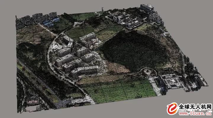
At this point, the 3D model of the dotted line with material cladding has been presented in Smart 3D, and then the amount of earthwork can be calculated in the Smart 3D software kernel.
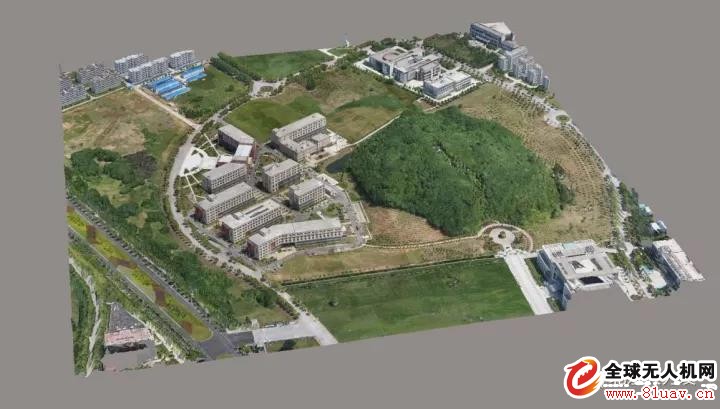
3 Real-life 3D model earthwork engineering calculation technology route
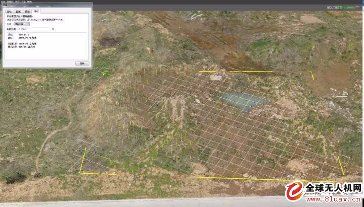
On the basis of the aerial photography acquired aerial survey data by the drone, the Smart 3D software is used to perform the three-dimensional encryption and other processing to generate the real-life 3D model, and then the arbitrary position can be selected on the Smart 3D software, and the contour and the elevation and the gradient are set. The way to draw the floor sketch by yourself, and to deduct the amount of earthwork that defines its location, as shown in the figure
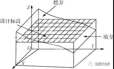
Earthwork calculation technology route
The Smart 3D software automatically selects the amount of earthwork between the “new construction†and the “existingâ€, and the values ​​in the left property bar show the values ​​of “cut/fillâ€, “fillâ€, and “sampling distanceâ€. The amount of “cutting the net value of the fillâ€, “filling the square†and “cutting the square†will directly show the net value of the excavation, filling and excavation and filling of the earthwork, as shown in the figure.
Technical advantages
The traditional earthwork calculation method has the disadvantages of large amount of calculation, low calculation precision, large amount of data, etc., and uses "area division based on topographic features - approximate simplification - taking appropriate measurement methods to obtain terrain 3D feature data - finally through 3D weight The method of constructing results in the calculation results. The method of thinking can achieve a fast and accurate calculation method, and can achieve "actual correspondence with the model" and "what you see is what you get". From the measurement of the terrain to the calculation of the earthwork, the labor cost and the time cost will be greatly reduced, and the accuracy of the measurement will be much higher than the traditional measurement method.
Application prospect
Using the method of aerial tilting photography real 3D model to simulate earthwork excavation and backfilling, on the basis of intuitive and effective excavation analysis and calculation of earthwork, the accuracy and refinement of earthwork balance calculation can be realized, and the time for dispute resolution can be saved. Project cost control plays an important role.
Watch Screen Protector, Watch Hydrogel Screen Protector,Smart Watch Screen Protector,Watch Protective Film,Apple Watch Screen Protector,Watch Screen Protector Cover
Shenzhen Jianjiantong Technology Co., Ltd. , https://www.jjthydrogelmachine.com